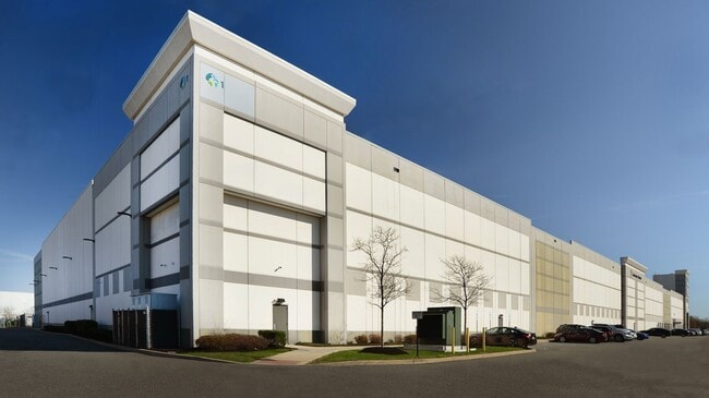
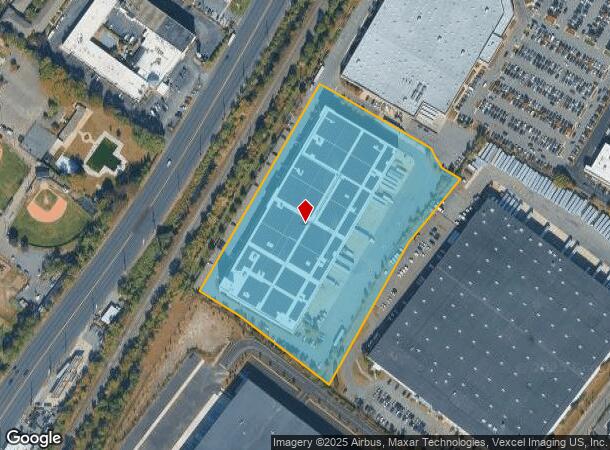
Property Record
Route 46 Hm, Teterboro, NJ 07608

NEARBY LISTINGS FOR SALE OR LEASE
Property Detail
Route 46 Hm
New York-Jersey City-White Plains, NY-NJ
7.89 ACRES
62-00202-0000-00004-09
Bergen
Vacantlandnec
New Jersey
X
4.9
34003C0252H
7.89 AC
2024
Teterboro Airport
2025
Northern New Jersey
036100
DEMOGRAPHICS near Route 46 Hm
1 Mile
3 Mile
5 Mile
2024 Total Population
13,761
203,518
593,408
2029 Population
13,559
199,070
580,112
Pop Growth 2024-2029
(1.47%)
(2.19%)
(2.24%)
Average Age
42
40
40
2024 Total Households
5,177
77,090
214,862
HH Growth 2024-2029
(1.49%)
(2.18%)
(2.22%)
Median Household Inc
$98,133
$76,845
$82,499
Avg Household Size
2.60
2.50
2.70
2024 Avg HH Vehicles
2.00
2.00
2.00
Median Home Value
$476,560
$429,318
$450,141
Median Year Built
1952
1957
1956
Nearby Places
Map Layers
Map Styles
 Street
 Aerial
- Restaurants
- Banks
- Shops
- Fitness
- Groceries
PUBLIC TRANSPORTATION
COMMUTER RAIL
Teterboro (Pascack Valley Line - NJ Transit Commuter Rail (NJ Transit))
DRIVE
WALK
Distance
Teterboro (Pascack Valley Line - NJ Transit Commuter Rail (NJ Transit))
3 min
0.9 mi
Essex Street (Pascack Valley Line - NJ Transit Commuter Rail (NJ Transit))
DRIVE
WALK
Distance
Essex Street (Pascack Valley Line - NJ Transit Commuter Rail (NJ Transit))
5 min
1.8 mi
AIRPORT
LaGuardia
DRIVE
WALK
Distance
LaGuardia
26 min
18.7 mi
Newark Liberty International
DRIVE
WALK
Distance
Newark Liberty International
22 min
18.7 mi
John F Kennedy International
DRIVE
WALK
Distance
John F Kennedy International
39 min
29.7 mi
SALE & LEASE HISTORY
LISTING DATE
SALE/LEASE

May 30, 2025
For Lease
Jun 19, 2025
For Lease
Nearby Properties
Address
Land Use
TOTAL SIZE
Lot Size
Zoning
Address
Land Use
TOTAL SIZE
Lot Size
Zoning
488,779 SF
7.55 AC
HCS
Address
Land Use
TOTAL SIZE
Lot Size
Zoning
Address
Land Use
TOTAL SIZE
Lot Size
Zoning
4,014 SF
21 AC
Address
Land Use
TOTAL SIZE
Lot Size
Zoning
612 AC
SEA
Address
Land Use
TOTAL SIZE
Lot Size
Zoning
335.71 AC
AF
Address
Land Use
TOTAL SIZE
Lot Size
Zoning
Address
Land Use
TOTAL SIZE
Lot Size
Zoning
Address
Land Use
TOTAL SIZE
Lot Size
Zoning
9.57 AC
I2
Address
Land Use
TOTAL SIZE
Lot Size
Zoning
4.37 AC
HCS
Address
Land Use
TOTAL SIZE
Lot Size
Zoning
281,720 SF
3.93 AC
R-3
Address
Land Use
TOTAL SIZE
Lot Size
Zoning
7.10 AC
R-3
Address
Land Use
TOTAL SIZE
Lot Size
Zoning
Address
Land Use
TOTAL SIZE
Lot Size
Zoning
608,596 SF
27.10 AC
LID
Address
Land Use
TOTAL SIZE
Lot Size
Zoning
232,368 SF
5.10 AC
Address
Land Use
TOTAL SIZE
Lot Size
Zoning
30.46 AC
I
Address
Land Use
TOTAL SIZE
Lot Size
Zoning
261,303 SF
5.60 AC
O
Address
Land Use
TOTAL SIZE
Lot Size
Zoning
8.79 AC
Address
Land Use
TOTAL SIZE
Lot Size
Zoning
4.80 AC
Address
Land Use
TOTAL SIZE
Lot Size
Zoning
394,046 SF
1.88 AC
R3
Address
Land Use
TOTAL SIZE
Lot Size
Zoning
2,191 SF
1.34 AC
B2
Address
Land Use
TOTAL SIZE
Lot Size
Zoning
13 AC
B-3
Address
Land Use
TOTAL SIZE
Lot Size
Zoning
31,896 SF
1.64 AC
O
Address
Land Use
TOTAL SIZE
Lot Size
Zoning
5.53 AC
RS
Address
Land Use
TOTAL SIZE
Lot Size
Zoning
340,218 SF
8.69 AC
B-3
Address
Land Use
TOTAL SIZE
Lot Size
Zoning
431,600 SF
2.70 AC
R3
Address
Land Use
TOTAL SIZE
Lot Size
Zoning
18.30 AC
Address
Land Use
TOTAL SIZE
Lot Size
Zoning
11.59 AC
Address
Land Use
TOTAL SIZE
Lot Size
Zoning
144,024 SF
1 AC
LM
Address
Land Use
TOTAL SIZE
Lot Size
Zoning
25.50 AC
B2
Address
Land Use
TOTAL SIZE
Lot Size
Zoning
431,600 SF
2.84 AC
R3
The World's #1 Commercial Real Estate Marketplace
Connect with us
© 2025 CoStar Group
The information above has been obtained from sources believed reliable. While we do not doubt its accuracy we have not verified it and make no guarantee, warranty or representation about it. It is your responsibility to independently confirm its accuracy and completeness. Any projections, opinions, assumptions, or estimates used are for example only and do not represent the current or future performance of the property. The value of this transaction to you depends on tax and other factors which should be evaluated by your tax, financial, and legal advisors. You and your advisors should conduct a careful, independent investigation of the property to determine to your satisfaction the suitability of the property for your needs.